Getting high in Northland: A peak-bagger’s guide to the North’s 10 highest mountains
Yes, I know what you’re thinking. Highest mountains? In Northland? A region where not a single peak rises to a paltry 800 metres above sea level?
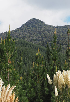
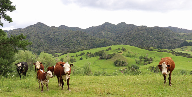
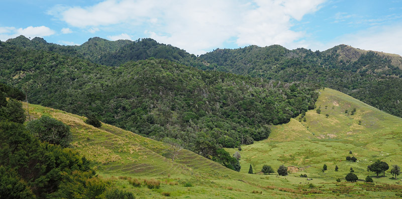
Granted, Northland is no mountaineering Mecca. It’s hard even to find decent multi-day hikes, thanks to the loggers who felled the region’s great kauri forests and left just isolated pockets of bush like islands in a sterile sea of pasture and pine plantations.
Despite the lack of elevation, however, there are challenges to be had bashing your way through sub-tropical bush in 95 per cent humidity and searching for barely-used tracks choked by undergrowth. Even locating some of Northland’s highest peaks is a challenge in itself.
Also, peak-bagging* in Northland presents some major advantages. If, like much of New Zealand’s population, you live in the upper half of the North Island, you won’t have to drive for days to reach your peak of choice. Northland offers cultural experiences you won’t find in the genuinely mountainous south, and you will never need crampons, ice axes or thermal underwear.
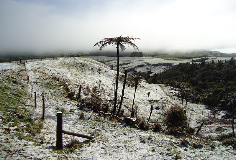
That said, it does snow in Northland occasionally, most recently in 2015 when snow dusted the tops of the Waima Range. In 2011 so much snow fell at Tutamoe, north of Dargaville, kids were able to have snowfights and build snowmen.
Another advantage of the walks described here is that they can be knocked off in a day, or in some cases, half a day. They shouldn’t, however, be taken lightly. They range from moderately hard to brutal. None should be attempted without prior tramping experience.
While you won’t need ice axes in Northland you will need a raincoat, good boots and possibly gaiters for the mud, a hearty lunch, plenty of water (it gets hot and streams are scarce in summer) and a cellphone. Make sure you let someone know where you’re going and when you expect to be back. In the wildest places you should consider bringing a locator beacon.

As an aside, in 2015 Northland was briefly able to lay claim to the highest point in New Zealand. An official sign at Mangamuka Summit, where State Highway 1 crosses the Mangamuka Ranges south of Kaitaia, put the elevation at 4383m. That’s 659m higher than Aoraki/Mt Cook, usually considered New Zealand’s highest mountain.
For a few weeks a local newspaper ran tongue-in-cheek reports about Northland’s potential as a skiing destination which were, unfortunately, also read by the government’s roading agency. The sign was fixed and now gives a more accurate, but much less interesting, elevation of 383m.
*Peak-bagging is a pastime which involves hiking to every summit in a specific area or above a certain height. Its most extreme form involves climbing the highest mountain on all seven continents.
Choosing the Top 10
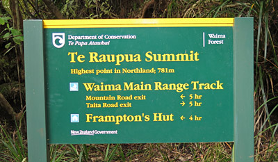
Compiling a list of Northland’s 10 highest peaks is more complicated than I expected. The highest point is clear-cut, albeit not by much — it’s the 781-metre-high Te Raupua in South Hokianga’s Waima Forest — but after that the list is open to argument.
The main Waima Range has many points above 700m which could qualify for the Top 10 on the grounds of height, but in my view they are all sub-peaks of Te Raupua rather than peaks in their own right. They include the wonderfully named Mt Misery (728m) on a spur off the main range and Wekawekanui (714m) which looms over the Wekaweka Valley. I have not included them in my list.
Ngapukehaua (762m) is also in Waima Forest but appears to be on a separate ridge north of the main range, so I believe it qualifies as a stand-alone peak. It comes in at number three.
Similar arguments could be had about many other peaks on this list. In general I have considered only the highest point in each range.
Serious peak-baggers get around this problem by ranking mountains not by height but by prominence, which is, roughly speaking, a measure of how much a peak sticks out above the surrounding terrain.
My list differs to others I’ve seen and is open to correction and debate. I’ve compiled it only by poring over maps so I may have missed some peaks. If you have a different list I’d love to know about it. Drop me an email via the about me page or, better still, add a comment to the bottom of this page and get a discussion going.
| Northland’s 10 highest peaks | |
| 1. | Te Raupua (781m), Waima Forest |
| 2. | Tutamoe (770m), Kaihu Forest |
| 3. | Ngapukehaua (762m), Waima Forest |
| 4. | Raetea (744m), Raetea Forest |
| 5. | Panguru (737m), Warawara Forest |
| 6. | Kowekaweka (719m), Mataraua Forest |
| 7. | Te Tarahiorahiri (697m), Mangakahia Forest |
| 8. | Hikurangi (631m), Hikurangi Scenic Reserve |
| 9. | Tangihua (627m), Tangihua Forest |
| 10. | Motatau (575m), Motatau Forest |
Now reading a list is all very well but what you want to know is how to knock the bastards off — as the late Sir Edmund Hillary so eloquently put it after conquering Mt Everest in 1953. Below I offer a basic guide to the peaks I’ve managed to climb so far. As you’ll see this is page is very much a work in progress.
1. Te Raupua
Height: 781m
Location: Waima Forest, South Hokianga
Nearest towns: Waimamaku, Ōmāpere
District: Far North
Enjoyability rating: 7/10 but only if you think bush-bashing and gruelling physical challenges are fun. The best part is the satisfaction of conquering the highest mountain in Northland.
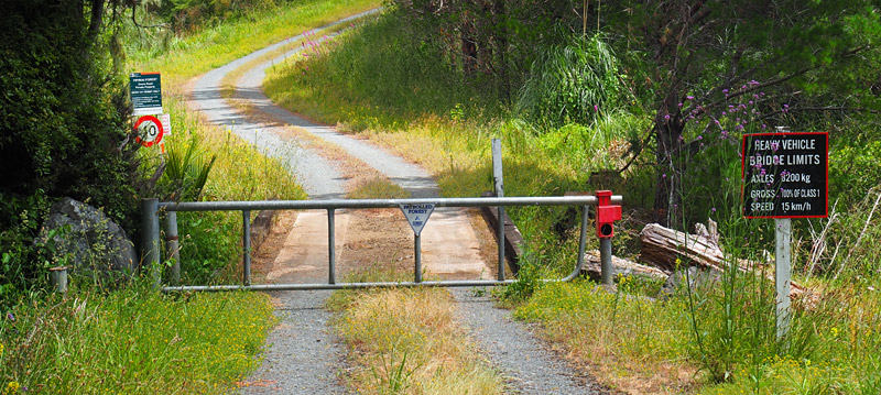
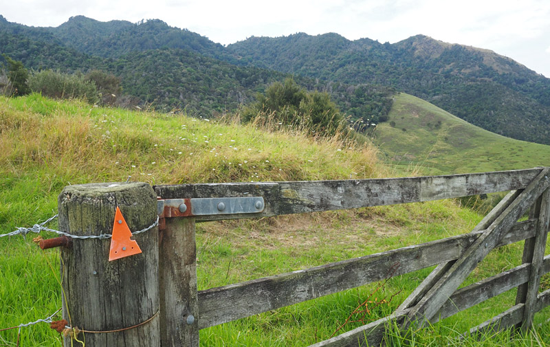
Getting there: There’s more than one way to climb Te Raupua so I’ll describe the shortest route here. Make your way to the South Hokianga settlement of Waimamaku, which is on State Highway 12 about 10km south of Ōmāpere or 75km north of Dargaville. Just south of the town centre head inland up Taita Road. After 5km you’ll see a small parking area on your right and the trailhead on your left. Note that Taita Road is unsealed, steep and narrow.
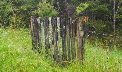
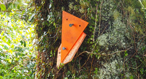
Knocking the bastard off: From the DOC sign on Taita Road follow Taita Bridle Track as it climbs the valley beside Oraora Stream, initially across rough farmland with pockets of bush, later through dense, mature forest. Near the start it’s easy to miss a sharp turn to the left and continue blundering straight ahead across the paddocks. Just keep looking for the orange triangles. If they disappear, backtrack to the last marker you saw and search for the track again.
This part of the walk is fairly straightforward despite the altitude gain. It should take 1.5-2 hours to reach the junction with Waima Main Range Track where the real fun begins.
Turn left at the junction and follow Waima Main Range Track as it climbs steeply up the side of the valley to the ridge. Then it’s just a case of following the ridge as it climbs to each successive high point, then descends, climbs again, descends… I think you get the picture.
At times the track is choked by undergrowth or blocked by windfalls. It’s a good idea to keep backtracking and re-establishing the correct route any time you lose sight of markers. It can be very muddy and slippery on the steep sections, plus the hook grasses are nasty. Gaiters would not go amiss.

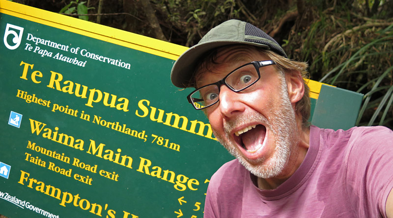
After 2.5-3 hours along the ridge you’ll suddenly be surprised by the summit. If the DOC sign wasn’t there you wouldn’t know. Te Raupua is more a gentle hump than a peak and the bush is so dense there are no views from the track (you’ll need to bush-bash several metres for even a limited view).
The return trip to Taita Road takes 8-10 hours. It’s not a walk to be taken lightly.
If you’re equipped for an overnight tramp and have a pick-up arranged at the other end, you could continue along the ridge for a few more hours then descend via Hauturu High Point Track to Waiotemarama Gorge Road, or via Six Foot Track and Frampton’s Hut to Mountain Road on the northern side of the ranges. Unless you’re hyper-fit count on spending a night in the bush.
The other way up Te Raupua starts on Waiotemarama Gorge Road. Follow the gentle Waiotemarama Waterfall Track to the falls (about 20 minutes), then climb through regenerating kauri forest up a seemingly endless staircase built to reduce the spread of kauri dieback disease. Allow about 3.5 hours to reach a short detour off the ridge track to 679m-high Hauturu (which, unlike Te Raupua, has views).
From there you can keep walking along the main ridge until you reach Te Raupua. Don’t ask me how long this would take. Going by the map I doubt I could knock off the return walk to Waiotemarama Gorge Road in a day.
Rehydration: Any serious mountaineer will tell you staying hydrated is essential. Fortunately, Waimamaku boasts the Waimamaku Bar & Grill with a basic menu and cheap beer. If that doesn’t take your fancy Ōpononi Hotel, 20km north on State Highway 12, has unspectacular but perfectly passable meals with views to die for.
2. Tutamoe
Height: 770m
Location: Kaihu Forest
Nearest towns: Parakao, Dargaville
District: Kaipara
Enjoyability rating: 8/10. Now I don’t want to hurt Te Raupua’s feelings but Tutamoe, though slightly lower, is the more satisfying climb. It has a well-defined peak with near 360-degree views and the last 20 minutes is a tough scramble that makes you feel you really have scaled a mountain. At a little under two hours each way it’s also very do-able as a half day outing. The only downside is the initial trudge along forestry roads.
Getting there: From Whangārei head west on State Highway 14 towards Dargaville. After about 45km turn right onto Tangowahine Valley Road. Confusingly, after 14km you turn left onto Tangowahine Valley Road (the tarsealed road carries on straight ahead but the name changes to Murray Road). After 6km on a gravel road you’ll spot a DOC sign marking the trailhead at a forestry entrance on your left. Leave your car in the parking area here; there’s a locked gate just up the road.
If you’re coming from the north make your way to Kaikohe then head south on Mangakahia Road/SH15 for 37km and turn right onto Opouteke Road, which becomes Murray Road. Turn right onto Tangowahine Valley Road.
Knocking the bastard off: The first 2km or so is a fairly tedious slog on a forestry road which forks regularly, so look out for orange posts and markers so you pick the right way. After the fourth fork (depending on how you count them) keep your eyes peeled on the left where a vague track leads into pine forest. There’s an orange triangle nailed to a tree stump but it’s easy to miss. If the road peters out at a forestry skid site littered with sun-bleached logs you’ve gone a little too far.
At first the track climbs steeply uphill through pine trees; it then follows a grassy ridge alongside a decrepit fence line. Eventually the track crosses a stile and drops into native bush.
From here on you’re in lush forest where every tree trunk is smothered in kidney ferns, vines and epiphytes. There’s also quite a few fearless feral goats.
After just under an hour and a half the track decides it’s time to gain some altitude. The last section is a steep, sweaty scramble up slippery boulders and tree roots.
Those flash walking poles won’t help you here — you’ll need both hands to pull yourself up using roots and supplejack vines.
It takes about an hour and 45 minutes to reach the trig station at the top where you’ll be rewarded with near-360-degree views across the Tasman Sea, Kai Iwi Lakes and many of the peaks on this list. Bream Head at Whangārei Heads was the most distant landmark I could recognise. Sharper eyes might see further.
Care is needed on the descent. The track is steep and slippery even in summer, and not recommended in the depths of winter or after heavy rain.
These days Tutamoe’s lower flanks are cloaked in pine forest but before loggers arrived the area was home to some of New Zealand’s biggest kauri trees, including the largest ever recorded. Kairaru had an estimated diameter of 6.4m and a height of 65m, making it significantly bigger than Tane Mahuta — the record holder for a living kauri with a diameter of 4.6m and a height of 52m. Sadly, Kairaru’s age and grandeur were not enough to save it from the axe.

Rehydration: After your conquest of Tutamoe you must stop at the Old Parakao Store a little further south on Mangakahia Road/SH15. One of the finest rural pubs in Northland, it is both characterful and full of characters (mostly the type who ride Harleys and wear beards down to their navels). It’s a cross between a café, a country pub, an automotive garage, a graveyard for vintage vehicles and a museum. A Parakao Burger washed down with Three Mountains beer brewed at nearby Maungatapere will sate any mountaineer’s appetite.
3. Ngapukehaua
Height: 762m
Location: Waima Forest
Nearest towns: Waima, Ōpononi
District: Far North
Ngapukehaua might be climbable via a ridge accessed from Waima School Road off State Highway 12. There are no formal tracks in the area and the terrain looks pretty brutal.
4. Raetea
Height: 744m
Location: Raetea Forest, Mangamuka Ranges
Nearest towns: Mangamuka, Kaitaia
District: Far North
UPDATE: State Highway 1 over the Mangamuka Ranges is currently closed and unlikely to reopen before November 2024. Until then Raetea can be accessed only from Takahue Saddle Road or Makene Road.
Enjoyability rating: 7.5/10. A surprisingly pleasant walk given Raetea Forest’s daunting reputation. It loses a few points because the peak itself is underwhelming and offers no views, though there is a viewpoint on the way up. I should also point out I climbed Raetea in late spring after a couple of weeks without rain. By all accounts this infamously swampy track would earn an enjoyability rating of 3/10 in winter, and that’s only if you like mud.
You have a couple of options for climbing Raetea. I’ll describe the easiest one here.
Getting there: Make your way to Mangamuka Saddle, the highest point on State Highway 1 as it winds its way over the Mangamuka Ranges about 25km south of Kaitaia or 35km north of Ōkaihau. The saddle is 383m above sea level, so you’re almost halfway to the top even before you put your boots on.
There’s plenty of parking space and the start of the track is well marked. The only catch is it’s not the safest place to leave your car. Pick a spot where your vehicle can be seen by passing drivers, don’t leave anything in sight that could tempt a thief, and bring any valuables with you.
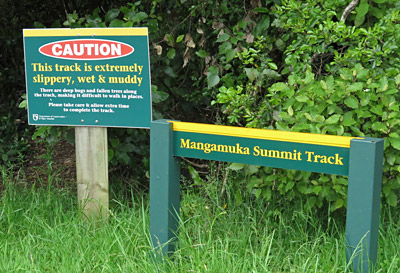
Knocking the bastard off: An ominous DOC sign at the start of Mangamuka Summit Track hints at what lies ahead: “This track is extremely slippery, wet and muddy”. Also: “There are deep bogs and fallen trees in places, making it difficult to walk.” You can’t say you weren’t warned.
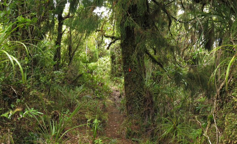
The only hazard the sign doesn’t mention is the tangle of roots and supplejack vines waiting to trip you up. Someone has been through with a chainsaw and cleared many of the downed trees, but there are still places where you have to bush-bash your way around a treefall. Be sure to confirm you are back on the proper track after any such detours; fortunately, the route is well marked with the familiar orange triangles.
After an initial climb the track follows an undulating ridge through native bush thick with ferns and moss, a testament to the area’s high rainfall and the mist which often clings to the tops of the Mangamuka Ranges.
The other product of rain is, of course, mud. The mud here is the thick, clayey kind which will try to suck your boots off or stick to them in huge clods. This is not a walk to be attempted in sneakers.
I walked the track after a prolonged dry period so it was no worse than any other New Zealand bush track but, unless you are particularly masochistic, it is best avoided in winter or after heavy rain.
It took me 1 hr 10 mins to reach the first junction, where Mangamuka Summit Track, Takahue Saddle Track (also called Mangamuka Track) and the track to Makene Road meet. DOC gives the walking time to this point as 2 hrs 30 mins, which is presumably how long it takes when conditions are poor. This junction is 727m above sea level, almost as high as Raetea itself.
From here you continue straight ahead on Takahue Saddle Road (also called Mangamuka Track). You’re now on Te Araroa, the long-distance trail from Cape Reinga to Bluff, and the track suddenly improves. I’m not sure if that’s because it gets more maintenance or just because there are more passing boots to keep the track clear. You also start seeing human footprints; until that point I saw only pig tracks.
After about 2 hrs 30 mins, much of it on a pleasant rimu-clad ridge, the bush starts to open up, offering glimpses of sky and forested ridges. A minor scramble though flax and cutty grass takes you to a high point with an 8km signpost (a Te Araroa marker) and the first decent view, across Broadwood farmland and the upper reaches of the Hokianga Harbour. Savour it, because it’s better than the view you’ll get from the top.
After another 5-10 mins you’ll reach a three-way junction. There are no DOC signs but the extra-large orange triangles tell you it’s a significant crossroads.
The main track continues right and descends the ridge towards Takahue. On your left is a lesser track marked only by a hand-made sign which once had “CAMP” carved into it. Follow that track as it rises gently for about 50m to a small clearing in the bush with a metal pipe fixed in the ground. I suspect this is all that remains of the original surveying station (or trig in Kiwi slang) marking the highest point in Raetea Forest.
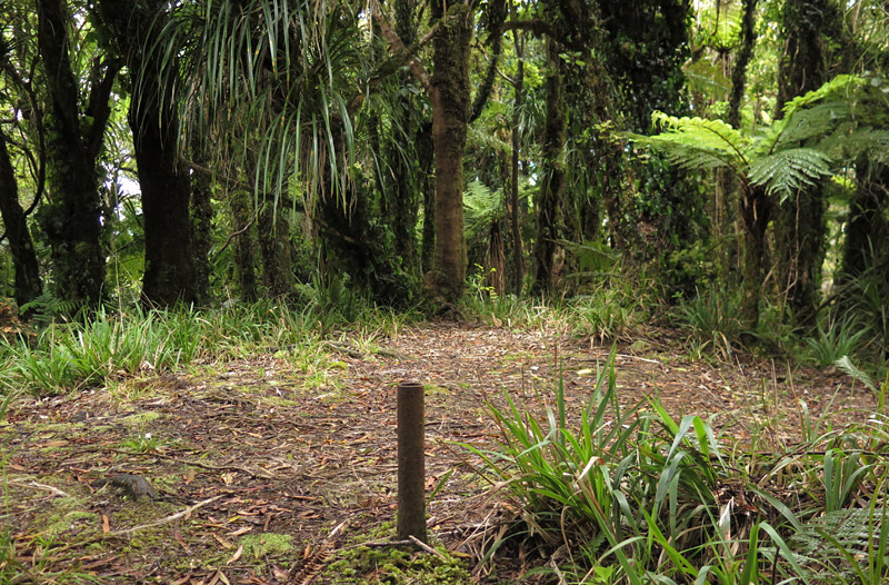
As far as peaks go it’s fairly underwhelming but if you continue another 50m you’ll reach a grassy clearing used as a campsite by Te Araroa walkers and a telecommunications station bristling with solar panels. You’ll find another viewpoint behind the transmitter.
The walk from Mangamuka Saddle to Raetea and back took me about 5 hrs 30 mins in near perfect conditions. The DOC estimate just to the first junction is 5 hrs return which would make the whole thing around 10 hrs. That is possibly overstated but it’s not a walk to be taken lightly.
Until Covid-19 closed the borders at least one lost or injured Te Araroa walker had to be winched out of Raetea Forest by helicopter every year; in 2018 rescuers said a 24-year-old German hiker was ”extremely lucky” to be alive after falling down a 20-metre waterfall. Perhaps the real miracle was that she had enough cellphone coverage in this area to give searchers a fix on her location.
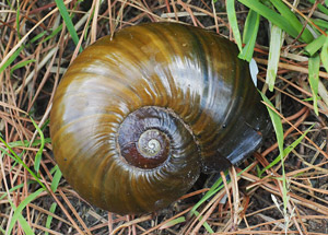
While the bush here looks healthy you won’t see or hear much wildlife, presumably a result of introduced pests. You will, sadly, see lots of smashed-up shells of the endangered kauri snail devoured by wild pigs.
I did, however, hear riroriro (grey warblers, whose song is the soundtrack of the New Zealand bush), pīpīwharauroa (shining cuckoos) and kūkupa (native pigeons).
As well as good boots, food, a map and a means of communication, be sure to bring plenty of water. It gets hot on the ridge and there’s no water near the track.
Other routes: You can also climb Raetea from the end of Takahue Saddle Road, off Takahue Road, south of Kaitaia (from this side the track is known as Mangamuka Gorge Walkway). It’s shorter this way but you start at a lower elevation so you have to do more climbing.
The best idea, however, is to persuade a friend/spouse to drop you off at Mangamuka Saddle and pick you up at the other end on Takahue Saddle Road. That way you’ll be walking mostly downhill and you won’t have to cover the same ground twice. The official estimate for the full walk is 9-10 hrs; check out the map and DOC’s track description.
Rehydration: There are no pubs in this sparsely populated area. However, Mangamuka Dairy, on State Highway 1 on the south side of the Mangamuka Ranges, serves ice cream and takeaways with a generous helping of manaakitanga (hospitality). This friendly store is a lifeline for Te Araora walkers.
If Mangamuka Dairy is closed, Ōkaihau, 30km further south, has a couple of decent cafés; otherwise Kaitaia has a range of (mostly) uninspiring pubs and eateries. Peekaboo, on Bank Street, is a notable exception.
5. Panguru
Height: 737m
Location: Warawara Forest
Nearest town: Panguru
District: Far North
There are no formal tracks in this area but locals regularly scale the summit, for example to mark Matariki (the Māori New Year). Panguru is the only mountain on this list which also features on a much more significant list, that of the maunga tapu (sacred mountains) of Ngāpuhi, New Zealand’s largest iwi (tribe). Like the pillars that hold up the roof of a house, these ten mountains support the sky that forms the roof of Te Whare Tapu o Ngāpuhi (The Sacred House of Ngāpuhi).
I hope to climb Panguru this summer.
6. Kowekaweka
Height: 719m
Location: Mataraua Forest, Wekaweka Valley
Nearest towns: Waimamaku, Ōmāpere
District: Far North
The direct route from Wekaweka Road looks impossibly steep but Kowekaweka might be accessible from Waima Main Ridge Track. The peak is only about 1km off the track but you can guarantee the bush is punishingly dense.
7. Te Tarahiorahiri
Height: 697m
Location: Mangakahia Forest
Nearest towns: Pakotai, Parakao
District: Whangārei
Again, the most direct route (from the west on Mangakahia Road) looks impossibly rugged. From the east NZ Topo Map shows a track starting at Drinnon Road passing about 1km east of the summit. It still looks brutal though.
8. Hikurangi
Height: 631m
Location: Hikurangi Scenic Reserve
Nearest towns: Awarua, Pipiwai
District: Far North
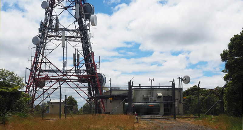
Enjoyability rating: 4/10 and that’s probably generous. A pleasant walk beside the Tokawhero Stream before the ascent begins saves it from being an entirely tedious slog on forestry roads. There’s not even a decent view from the summit to redeem this peak, unless of course you find transmitter towers aesthetically pleasing.
Getting there: The easiest way to access Hikurangi is from Mangakahia Road/State Highway 15. If you are approaching from the north, turn left when you reach Awarua, 22km south of Kaikohe, onto unsealed Tokawhero Road.
If you are coming from the south, Tokawhero Road is on the right 62km northwest of Whangarei. From this direction you’ll get a good view of the broadcast tower perched atop Hikurangi.
Another option is to approach the mountain from the east, but that involves driving a greater distance on dodgy roads. In that case you’d follow Pipiwai Road as far as Kaikou Marae and turn right onto Lovatt Road (if you’re coming from the north), and see how far you get.
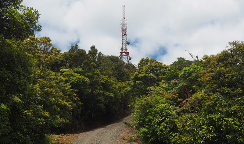
Knocking the bastard off: Of all the mountains on this list, Hikurangi is perhaps the most conquerable. It’s arguably also the least rewarding. That’s because there’s a four-wheel-drive track all the way to the broadcast tower at the summit. If you had a suitable vehicle and keys to the gate, you’d be able to drive all the way.
If you are accessing the mountain from Tokawhero Road, at some point you will have to abandon your vehicle. In my case that was after a mere 4km, when the ruts in the road became too deep for my car’s tiny wheels. With a four-wheel-drive you would likely be able to drive another 3km. This is a forestry area and the road is narrow, so beware of oncoming trucks if logging is in progress.
Tokawhero Road hugs a stream of the same name as it meanders gently through the forest. This is the most pleasant part of the walk/drive with native bush providing shade, deep pools inviting a swim, and plenty of birdsong.
Just over 5km from the SH15 turnoff you’ll see a side road on your left which descends to a ford across a stream. Ignore it and keep going straight ahead (there’s a locked gate at the ford anyway).
A short distance further you’ll come to a small bridge and another locked gate. This is where you’ll finally have to get out and walk if you’ve managed to drive this far.
I should probably point out this is a private forest and technically you need to ask Hancock Forestry Management for permission to enter. Be sure to leave no litter or other traces of your visit, not that you’d do that anyway.
From the gate the four-wheel-drive track climbs steadily through pine forest. After about 40 minutes you’ll reach a T-junction with BCNZ Road. Turn left and continue uphill. You’ll soon get your first glimpse of the broadcast tower through the trees. At this point it looks disturbingly far away, though it’s only about 3km as the crow flies.
After the junction the road becomes steep and takes about an hour to wind up to the summit. Pink foxgloves alongside the road add a splash of colour to what’s otherwise a fairly uninspiring walk.
A flat area at the top is almost entirely occupied by the transmission tower and humming outbuildings surrounded by a tall fence. There’s a wee grassy area suitable for a celebratory lunch or a nap. Trees and buildings block all but a few hints of a view.
Take care on the way back down – the road is steep and the gravel unforgiving.
Rehydration: Nope, nothing here. The best you’ll find is a cold soft drink at Tautoro Store, 12km north of Awarua on Mangakahia Road/SH15, if it’s open. It’s a community-minded store so you won’t find any booze or smokes.
9. Tangihua
Height: 627m
Location: Tangihua Forest
Nearest towns: Maungakaramea, Maungatapere
District: Kaipara
WARNING: Two of the tracks described here are officially closed. One is heavily overgrown, narrow and steep in places, with near-vertical drop-offs on either side. I was unable to reach the highest point. Take care if you are attempting the summit and be sure to tell someone where you’re going and when you’re due back. Bring a good topographic map and/or GPS, a means of communication, and ideally a tramping companion. A head for heights is also useful.
Enjoyability rating: 7/10 but only if you enjoy serious bush-bashing and don’t mind heights. If you prefer your tracks well formed and marked, the enjoyability rating drops to 3/10.
Getting there: The Tangihua Ranges lie just south of State Highway 14 between Whangārei and Dargaville. There are two access points — one official, the other less so.
From the south you can access the ranges from Omana Road and the well-marked Tangihua Lions Lodge (make your way first to Mangapai/Tauraroa or Maungakaramea, both of which are signposted from State Highway 1 south of Whangārei).
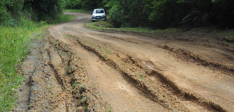
To access the north side of the ranges, head west on State Highway 14 from Whangārei for 24km. Turn left onto unsealed Otuhi Rd and continue straight ahead when the name changes to Codlin Road. Finally, turn right onto dead-end Tangihua Road and follow it to the end. The road is narrow and in poor condition in places.
Knocking the bastard off: There are two routes to the tops of the Tangihua Ranges. The advice from DOC is to use the southern entry from Omana Road, because the northern access from Tangihua Road is officially closed.
However, I’m going to describe the northern route here because it’s much closer to Tangihua Hut — the only tramping hut in Tangihua Forest and one of just a handful in Northland — and it’s also handier to the highest points of the ranges.
The start of the track is not marked but it’s easy to find. At the end of Tangihua Road you’ll see a small parking area with a kauri dieback notice and a sign declaring ‘Council maintenance ends here’. Nailed to a gatepost on your left you’ll see an orange triangle marker. That’s the start of the track.
The first part of the track crosses private land. As a courtesy you should ask for permission (you’ll find the Herberts of Tangihua Road in the online White Pages; otherwise knock at the nearest farmhouse) but as long as you close any gates behind you, you’ll be fine.
After about 15 minutes the route heads uphill on a rough farm track next to an electric fence. Keep an eye out for a wooden gate on your right with a couple of orange markers. After the gate the tracks descends into a bush-clad gully.
If you miss the gate, don’t do what I did, which was to keep blundering along the farm track. If you haven’t seen an orange marker for a while, backtrack to the last one you saw, then search the area until you find the next one.
After about 50 minutes you’ll come to a clearing and a track junction with a sign saying ‘Loop Track to Hut’.
The sign claims the left-hand trail is easy and takes about three-quarters of an hour, while the right-hand option is a steep 30 minutes.
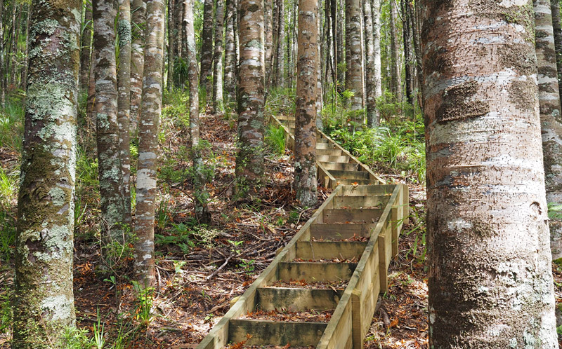
Both of those times are overstated. They took me about 25 and 20 minutes, respectively, and I’m no sprinter. Of the two, the steep option is probably the more pleasant. It has been recently upgraded with wooden steps and gravel surfacing to reduce the spread of kauri dieback. The ‘easy’ option has a few swamps to wade through.
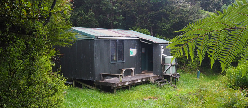
From the end of the road to Tangihua Hut should take less 90 minutes. It’s a rustic, old-school hut with eight bunks and a rainwater tank with an external tap.
You can’t book a bunk — the hut operates on a first-come, first-served basis — and payment is by backcountry pass or by hut ticket in an honesty slot. (Surprisingly, it is not possible to buy hut tickets in the district where I live. Here’s the full list of outlets.)
I wanted to stay the night so I left my pack at the hut and continued to the tops with a daypack.
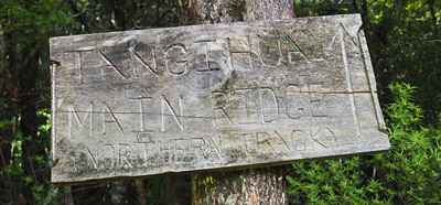
Immediately behind the hut you’ll see a carved sign stating ‘Tangihua Main Ridge (Northern Track)’.
At first the track leads you uphill through a lovely stand of young kauri and more newly built steps; after that the track turns rough with lots of gnarly roots and nasty hook grasses.
After an unrelenting 50-minute climb the track reaches the ridge, where it swings sharply to the left and drops steeply downhill. On your right is where the old Tangihua Summit Track used to start (look for a distinctive double marker).
DOC closed the track and removed the markers more than a decade ago when it was deemed too dangerous. These days the track is overgrown and at times you’re forced to crawl under fallen trees.
While it’s hard work bashing your way through a decade-plus of Northland undergrowth you can’t really get lost. The track follows a ridge which is less than a metre wide in places with steep drop-offs on either side.
I’ve spoken to keen walkers who’ve reached the top without much trouble but I had to give up after half an hour, when I was still about 600m from the summit (if the GPS is to be believed).
At that point the track plunges off what I’d describe as a cliff. Braver and more rational hikers would describe it as a steep slope of bare earth.
I could see a way to slide or scramble down, but I couldn’t see a way back up. I also didn’t like the look of the much bigger drop that awaited me if I lost my footing on the way down.
Ironically, given that this is a blog about Northland’s ten highest peaks, I have no head for heights so I turned back, mission unaccomplished. This peak will have to be someone else’s to conquer.
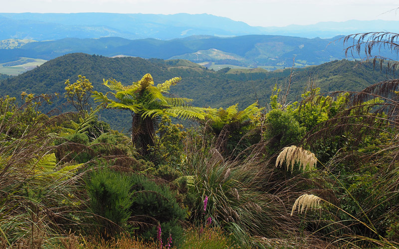
Even though I didn’t get to the highest point of the Tangihua Ranges, I was rewarded with better views then I’ve had from most of the peaks higher up on this list.
The 360-degree panorama stretches from Kaipara’s Wairoa River in the west to Whangārei Harbour, the volcanic crags of Whangārei Heads and jagged Taranga Island (of the Hen and Chicken Islands) in the east.
One disappointment about the Tangihuas was the lack of wildlife. In two days I heard just one tūī and for long stretches of track there’s a dead kauri snail every metre. Smashed and eaten by wild pigs, every one.
Starting from Omana Road: It’s possible to get to Tangihua summit — or close to it anyway — in a day trip from Tangihua Road. If you enter the ranges from the south side, however, you have no choice but to made it an overnight trip. DOC gives a time of seven hours from the Omana Rd entrance to Tangihua Hut via Te Haua Ura Track and Northern Tangihua Track.
Rehydration: The nearest town, Maungatapere on State Highway 14, does not seem to have a pub. What it does have is a cafe called The Office in an old dairy factory (open Monday to Friday) and New Zealand’s only museum dedicated to the Packard motorcar. Otherwise there are plenty of places to rehydrate in the nearby Northland megapolis of Whangārei.
10. Motatau
Height: 575m
Location: Motatau Forest
Nearest towns: Purua, Motatau
District: Whangārei
The twin peaks Motatau and Matori are known collectively as Motatau Maunga [mountain], which looms over an isolated valley of the same name. Access is via private farmland or plantation forest.
Honourable mentions
Maungataniwha (572m) is the highest point on the eastern side of the Mangamuka Range, which is divided by State Highway 1. (The highest point on the western side is Raetea, number 4 on the list.) Maungataniwha is topped by a broadcast tower which is visible for tens of kilometres; a four-wheel drive track leading to the summit allows for maintenance. Maungataniwha is one of the sacred mountains which mark the borders of Ngāpuhi, New Zealand’s largest iwi (tribe), so the presence of the tower is controversial, to put it mildly.
Taumatamahoe (558m), Toetoehatiko (543m) and an apparently unnamed peak (539m) are the highest points in Herekino Forest, Waipoua Forest and Omahuta Forest, respectively.
Te Whara (476m) is the highest point on one of the best day walks in Northland — the five-hour tramp over the rugged volcanic outcrop that guards the entrance to Whangārei Harbour. The walk starts at Urquharts Bay, Whangārei Heads, and ends in the surf of Ocean Beach. There’s even a DOC hut (a rare thing in Northland) at Peach Cove if you want to make it an overnight trip. The first section to the top of Mt Lion is a slog but the views are stupendous. It’s as spectacular as anything in the more famous Bay of Islands but it’s little known outside Northland.
Maunganui Bluff (459m), on the west coast, marks the northernmost point of Ripiro Beach, New Zealand’s longest drivable beach at 107km. A well-formed track leads to the summit from Aranga Beach (off State Highway 12 north of Dargaville) with spectacular views down the coast. The walk up the bluff is also the start/end point of the officially closed, but still walkable, Hokianga Coastal Track.
Mt Manaia (420m) is, like Te Whara, a fabulous walk up the remains of an ancient volcano at Whangārei Heads, but at an hour each way it’s much more do-able. The track ends at a natural rock platform with amazing views but no barriers (hold onto the kids!). The rocky spires at the very top are tapu (sacred) to Ngātiwai, the local iwi.
The Pinnacles (417m) form the high point on Taranga Island, one of the Hen and Chicken Islands off Bream Bay. It’s remarkably high given the size of the island. Taranga is, however, a scientific reserve home to critically endangered species and is strictly off-limits to visitors.
The sheer-sided, flat-topped Taratara (302m) is one of the most dramatic landmarks you’ll see as you head north on State Highway 10 beyond Kāeo. It is, however, also off-limits. Used for centuries as a burial site for tūpuna (ancestors), Taratara is strictly tapu (restricted/forbidden).
Pilbrow Hill (292m) is one hill every visitor to Northland will be familiar with. It’s the high point of the Brynderwyns, near the border of Auckland and Northland. Driving over the summit on State Highway 1 reveals a magnificent view over Bream Bay and the volcanic peaks of Whangārei Heads.
Tokatoka (123m) may be small but I reckon it’s the best-looking mountain in Northland. This sheer-sided volcanic plug on State Highway 12 south of Dargaville looks like something out of the sci-fi movie Close Encounters of the Third Kind. It also looks impossible to climb but there’s a surprisingly straight-forward track to the top starting a few hundred metres up Tokatoka Road. It takes about 20 minutes to reach the summit.
All elevation data is sourced from NZ Topo Map.